Platform provides aerial imagery insights into farming, agriculture
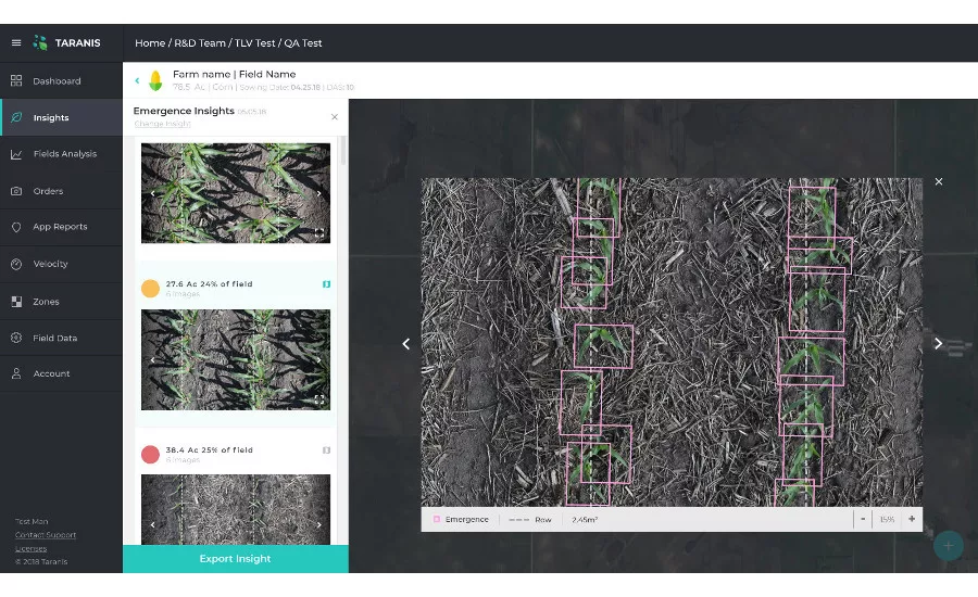
Taranis, New Richmond, Wis., launched an updated, insights-centered platform, designed to help farmers and agriculture retailers glean insights into how to improve their yields.
This platform for aerial imagery insights for agriculture utilizes deep-learning technology combined with high-speed UAVs and manned aircrafts to enable farmers to predict and prevent threats to over 20 million acres of crops on a granular level, such as identifying an actual type of insect on a singular leaf. These unprecedented insights help farmers better manage crops around seed emergence, weeds, insect damage, nutrition deficiency, fertilizer top and side dressing, yield estimation, harvest priority and automated scouting.
The solution merges the benefits from its existing platform with the capabilities of Mavryx's aerial imagery platform, a company Taranis acquired in 2018. This includes insights from Taranis' AI2 (sub millimeter imagery samples) and UHR (high-resolution full field imagery to recognize problematic zones), combined with other technologies like satellite images and weather forecasts.
Taranis
715-443-5006
www.taranis.ag
Looking for a reprint of this article?
From high-res PDFs to custom plaques, order your copy today!

")